Field variation mapping is a new way of finding in-field variation, using multiple layers from two different satellites, which offers some very useful information at a competitive cost.
Field variation mapping looks at soil moisture index, soil properties, NDVI of a crop’sperformance and canopy cover to create one field variation map.
Gone are the days of comparing maps side by side, thanks to our map stacking ability.
The main advantage of using satellite data above an infield sensor is that we can get the data regardless of weather or crop. We can look back over three years to get the data you need for your field.
Service use
Benefits
- P and K offtake more uniform
- More consistent harvesting speed
- Soil zones for variable rate P and K
- Problem areas to place broad-spectrum Solvita samples
What is involved
- Send the precision team your field locations. We request the data from the satellites and provide you with a variation map
- Visual notes from the agronomist and growers
- This combination can provide key information regarding zone performance
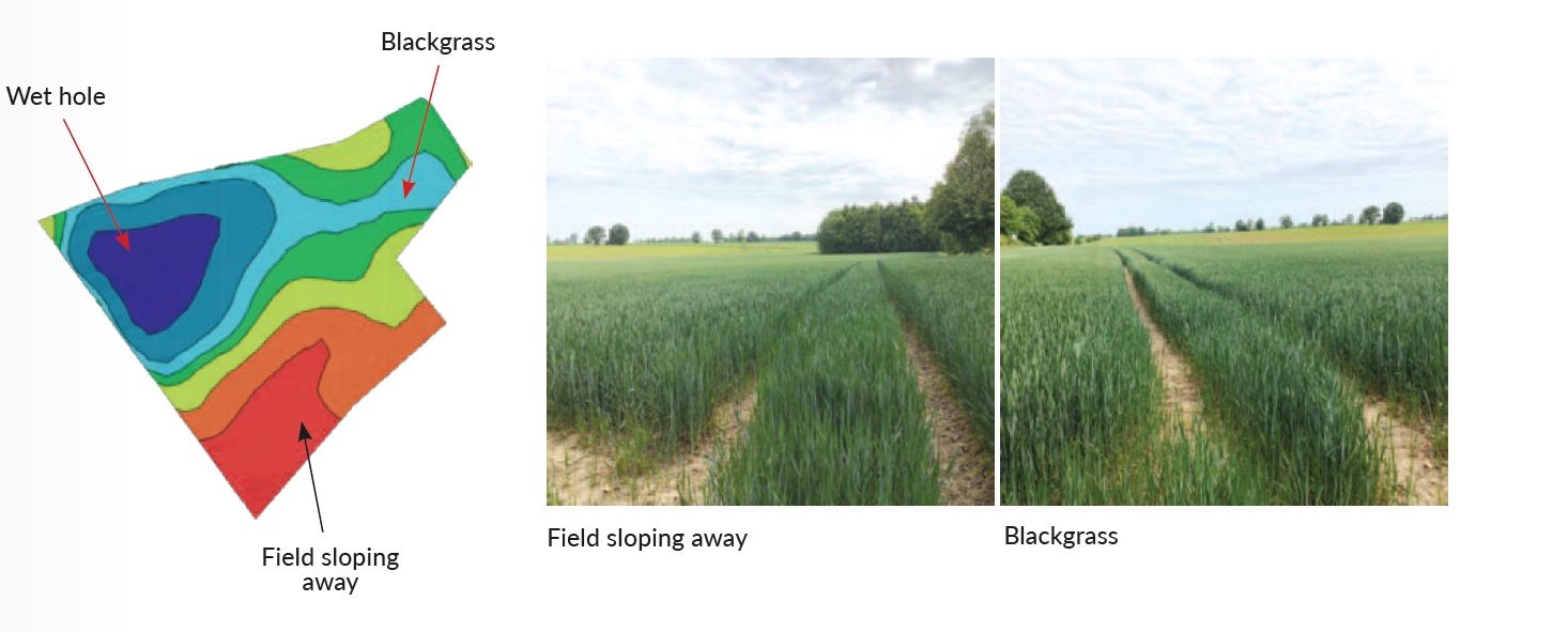
Obtaining a soil sample from high and low productive areas will provide an accurate indication of soil structure across the field (additional cost). In the example the red areas of the field are sandy clay loam with lower potassium levels and lower pH and the blue areas are clay loam with lower phosphate levels.
This data can be used to compare fields across the farm rather than just variation within the field (additional cost).
Seed rates in the first year are varied in a conservative manner and the most accurate way of providing the best maps is to count establishment percentages in year one. Zones will not change but tweaking rates is very important.